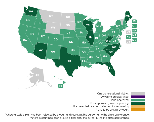
We at USgeocoder.com have been closely monitoring the redistricting process for each state. Starting in process for each state. Starting in approved and litigation resolved, we integrate the state's new district definitions with our precise GIS data and the latest postal data to produce new zip-to-district files. We update these files every month as the USPS updates its address files.
USgeocoder also offers existing district data from congressional to school, along with census stats and mailing delivery data for all states. Click here to view full line of district data files we provide.
USgeocoder delivers the most accurate and most frequently updated USPS integrated GIS data for your advocacy business, and mapping needs. As 2012 elections approach, our new district data files ensure accurate district to address matching that is critical to your campaigns.
You can use our new district data in many ways:
Contact us now to find out how we can help you stay on top of redistricting changes.
Learn the Power of USgeocoder that gives you unmatched level of confidence for your success.
Congressional and State Legislative Redistricting
Redistricting is reshaping the US political landscape. Districts are gaining and losing addresses. Politicians will be representing new territories. Voters might not be voting in the same districts. We have the new congressional and state zip-to-district data for candidates running for elections and those supporting or opposing them in 2012.
(This live update information is provided by Professor Justin Levitt at LOYOLA University Law School, an election law and redistricting expert. For more detail live updates, please visit Professor Levitt's website: http://www.redistricting.lls.edu/)


Copyright USgeocoder LLC. All rights reserved.