TALK TO US: (888) 938-6732

TALK TO US: (888) 938-6732


Custom GIS Mapping
With the advanced GIS mapping engine we developed, we can provide custom GIS mapping service with your own data file!
All of the following layers running on USgeocoder maps can be used with your data to develop custom maps such as political district maps and zip code maps for your applications:
This is an example of the base map generated by USgeocoder GIS mapping engine on August 20, 2025. You can customize the map by turning on and off layers of information to display. We can customize the base map to show whatever layers of information you want. We can add additional informational layers per your request.
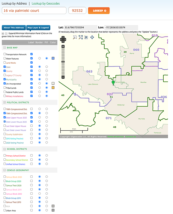
Any combination of layers and corresponding labels can be used for your maps. We provide both API and custom application design services to fit your particular needs. We can even host your web application in our state-of-art co-location facility located in the heart of Silicon Valley.
Want to hone your advertising or identify those most likely to support your message, buy your product, or contribute to your cause? Combine our GIS data processing, GIS mapping, and demographic analysis tools to create clear images that tell you where your buck will get the biggest bang! Use USgeocoder at a fraction of the cost of other providers!
Copyright USgeocoder LLC. All rights reserved.